
OUR FOCUS
Marine Spatial Planning
Marine Spatial Planning is a public, stakeholder-driven and science-based process that uses spatial information about natural resources and human uses to determine the best uses of ocean spaces through a comprehensive management plan.
The goal of Marine Spatial Planning is to balance the competing demands on marine resources to ensure that they are used in a way that is environmentally responsible, economically beneficial, and socially equitable.
Marine Spatial Planning also helps to identify important marine habitats and species that need protection, and to plan for potential impacts of climate change on the marine environment.
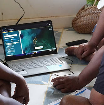
It is a public participatory process that uses the best available information about the natural environment and human activities (such as fishing, shipping, renewable energy, aquaculture, and infrastructure) to direct how we plan for future use and conservation of ocean space.
The Marine Spatial Planning team brings technical expertise to support our government partners in developing and implementing Marine Spatial Plans, in support of a more sustainable future for our ocean.

BY THE NUMBERS
125+ countries around the globe are using Marine Spatial Planning to manage their ocean spaces. UNESCO
OUR APPROACH


Scientific & Policy Assessments
Stakeholder Engagement
Marine Spatial Plan Development
Stakeholder Consultations
Marine Spatial Plan Adoption
Implementation & Monitoring
RECENT WORK

The Samoa Marine Spatial Plan establishes an ocean management system designed to protect, conserve, and manage marine resources within Samoan waters.
The Marine Spatial Plan was developed by the people for the people of Samoa. It includes the establishment of nine new fully protected Marine Protected Areas (MPAs), which will be formally designated pending passage of legislation. The Plan also incorporates existing nearshore managed areas. It aims to ensure that various ocean activities are managed holistically.
Implementing the Marine Spatial Plan contributes to sustaining ocean health, preserving ecosystem services, and achieving socio-economic priorities. It also supports Samoa’s global commitment to the 30x30 initiative, which aims to protect 30% of Samoa's Exclusive Economic Zone (EEZ) by 2030.
Learn more about the Samoa Ocean Strategy.

Bermuda seeks a future where its marine waters contain healthy ecosystems that can support a thriving and more resilient ocean-based economy while balancing the diverse priorities of ocean users.
Bermuda’s Blue Prosperity Plan delivers on this vision with two parts that work together:
-
Marine Spatial Plan: A framework for implementing sustainable ocean development, protection, and management.
-
Blue Economy Strategy: A guideline for growing Bermuda's ocean-related industries and attracting investment opportunities.
The Marine Spatial Plan ensures that 20% of Bermuda’s marine waters are fully protected marine protected areas (MPAs).
Learn more about the Bermuda Ocean Prosperity Programme.
OUR TEAM

BROOKE DIXON
Science Manager
Coordinates the planning and implementation of Ocean Use Surveys across project sites.

FATHIMATH NISTHARAN
Marine Spatial Planning Manager
Collaborates with local partners to guide the Marine Spatial Planning process.
JOHN KAITU'U
Marine Spatial Planning Technical Manager
Assists partners in mapping and managing Marine Spatial Planning data and activities across their ocean space, helping them navigate national priorities through an informed decision-making process.

CORY PUKINI
Enforcement and Compliance Program Manager
Manages enforcement and compliance initiatives and works to build key partnerships to advance the implementation of Marine Spatial Planning.

DR. SHAISTHA MOHAMED
Stakeholder Engagement Manager
Manages efforts to engage diverse stakeholders in the development of long-term plans that balance ecological preservation with economic and social well-being.

EMILY STOKES
Marine Spatial Planning Manager
Works to facilitate collaborative, equitable and open planning processes that lead to strong spatial protections and sustainable management.
OUR PARTNERS


.jpeg)


